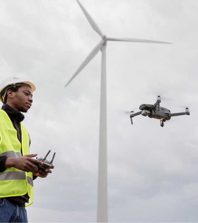
Technology driven land surveying solutions
Space Surveying and Spatial Planning is renowned for delivering the very best results through a range of different surveying techniques that we have perfected overtime ensuring professionalism, efficiency, and unwavering dedication for our clients
Space Surveying and Spatial Consultancy
By combining strategic thinking, multidisciplinary perspectives and technical expertise we do more than effectively solve our client challenges. We serve clients ranging from Global energy companies to governments and local authorities
Mining Surveys
measurement of mine workings to assist with their design, planning, and improve the safety of any mining operations
Cadastral Surveys
Delineation of property and proper documentation of property rights commonly known as cadastral surveys
Aerial Surveys
3D modelling and mapping of sites or any other ground based features using data collected from aerial data platforms
Topographical Surveys
accurate depiction of a site that's scaled and detailed to show all the natural manmade features and their levels
Construction Surveys
this involves the evaluation and estimation of construction activities before the beginning of the project
Our Clients
Some of the clients who utilize our solutions
Architects
Infrastructure Projects
Property Consultants
Property Developers
Quarries
Mines
Drone (Unmanned Aerial Vehicles) Surveys
Using Our own CAAZ certified pilots to carry out drone (UAV or
RPAS) surveys we also process drone data collected by our
clients. Some of our clients capture their own drone imagery
but dont have the time or in house expertise to undertake more than basic image processing and volume calculations
Data Processing

Mission
To operate as a client driven competitive business and deliver the best results for our clients for their optimum use of their land with cost-effective strategies.
Frequently Asked Questions
Email us if you have any questions
why is drone survey superior to traditional methods?
UAVs and drone surveying enable getting comprehensive data from remote, hazardous, or unsafe locations. We accumulate more substantial detailed information in a more condensed method, granting this to be more cost-effective for users when opposed to traditional methods. Therefore, drone surveying delivers exceptional results with greater urgency, practicality, and security.
what are current applications of aerial technology?
A few functions carried out and acknowledged by aerial technology are aerial photography/videography, aerial surveys, traffic monitoring, military surveillance, use in the construction industry, power line inspections, agricultural land inspection, healthcare, logistics, Solar panel and wind turbine maintenance, etc.
what's the process around each drone survey operation?
Every project requires customized drone operation plans because they are all different. Taking the example of aerial photography, we subsequently execute drone operations: Research and Development : Includes learning, gathering information about projects, studying aviation charts, and the atmosphere surrounding the targeted regions to identify any risks or hindrances. Planning : Permits us to compose a foundation to approach projects and resources needed in terms of equipment, personnel, costs, etc. Execution : Before actual implementation, a pre-flight evaluation of the drone’s condition is crucial. The plan is then put into action on the field as per demand. Analysis : We feed various software gathered to get technical information. Video editors are also a part of this stage and use their expertise for added creativity.
which drone technology does the SSSP consultancy use?
Since drones have distinct applications, they have grown to become an integral component to various private and governmental organizations. We have made our place in several industries through quick, reliable, and safe deliveries. Catering to military bases, and to the mapping of agricultural land surveys, our technology can do it all. Using innovative survey drones, artificial intelligence, and a plethora of advanced sensors like thermal, RGB, Lidar, etc. we extend our drone technology to many.
why drone technology for surveying?
Drone Surveys enable you to capture extensive and reliable data from places inaccessible to you. Survey drones offer high-resolution orthomosaics & comprehensive 3 Dimensional (3D) representations. Drone Surveys contribute vital knowledge to empower well-informed decision-making during the initial stages of construction site mapping, surveying, or inspection of infrastructure. It ensures that users maintain control and anticipate failure to secure maximum goodwill of their assets. Wind Turbine Blades, highways, and power lines frequently probed through this novel drone technology. When compared to conventional ‘at- height’ working, it reduces the significant risk for the workers during an inspection.
